GPS geodetic GeoPen HEXA with APGLOS for Mobile GIS

Rp.17,000,000

Pre-Order 8 Hari

1408 Channel

BEIDOU: B1I, B2I, B3I, B1C, B2a, B2b1

GPS: L1 C/A, L1C1, L2P (Y), L2C, L5

GLONASS: L1, L2

GALILEO: E1, E5a, E5b

QZSS: L1, L2, L5

§Based on the new generation GNSS SoC -Nebulas?TM, with RF-baseband and high
precision algorithm integrated
§Supports all-constellation all-frequency on-chip RTK positioning solution.
§Supports BDS B1I/B2I/B3I/B1C/B2a/B2b* + GPS L1/L2/L5 + GLONASS L1/L2 + Galileo E1/E5a/E5b + QZSS L1/L2/L5 + SBAS
§All-constellation all-frequency RTK engine and advanced RTK processing technology
Instantaneous RTK initialization technology


Main Features:
– NTRIP-RTK Ready for centimeter accuracy
– Can be a mobile BASE for Correction
– Powered by any PowerBank
– Pole/Jalon Mounting ready
– Raw Data Logger for Post Processing
– Wireless Bluetooth connection

CATALOG ORDER VIA BUKALAPAK ORDER VIA TOKOPEDIA

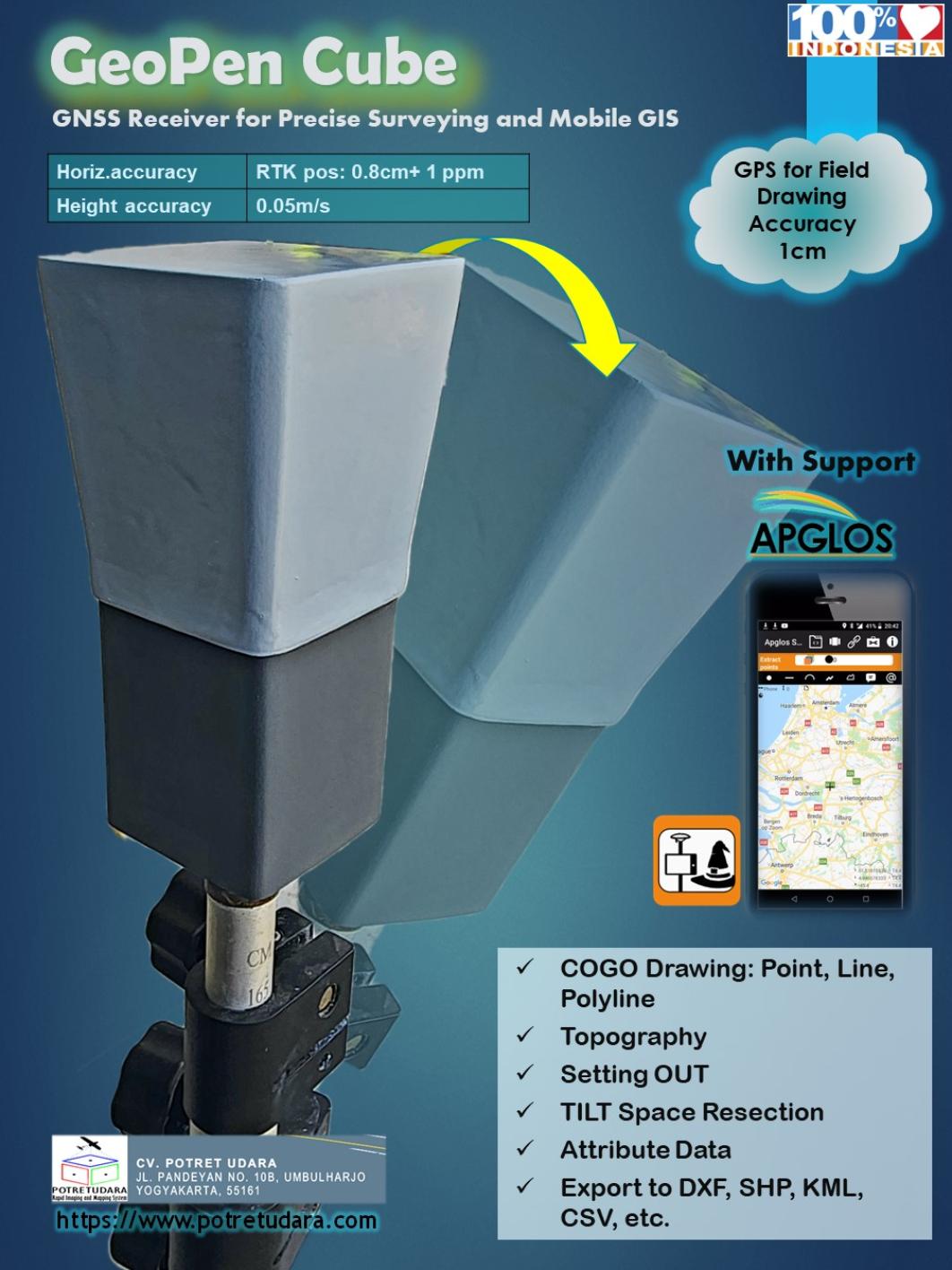
Multi-Purposes GPS for GIS GeoPEN
complete witg APGLOS program for TILT computation
APGLOS is surveying software for Android that change your smartphone to become a precise Data Collector


A post shared by potretudara (@potretudara)


A post shared by potretudara (@potretudara)


SUPPORT SURVEY MODE:
- Static Relative Post Processing for Ground Control Point ? accuracy less than 1cm
- NTRIP Realtime Kinematic with CORS Station ? accuracy less than 5cm
- PPP Online with IGS Network ? accuracy less than 15cm
- PPK (Post Processing Kinematic) ? accuracy less than 5cm
- RTK with Radio ? accuracy less than 5cm
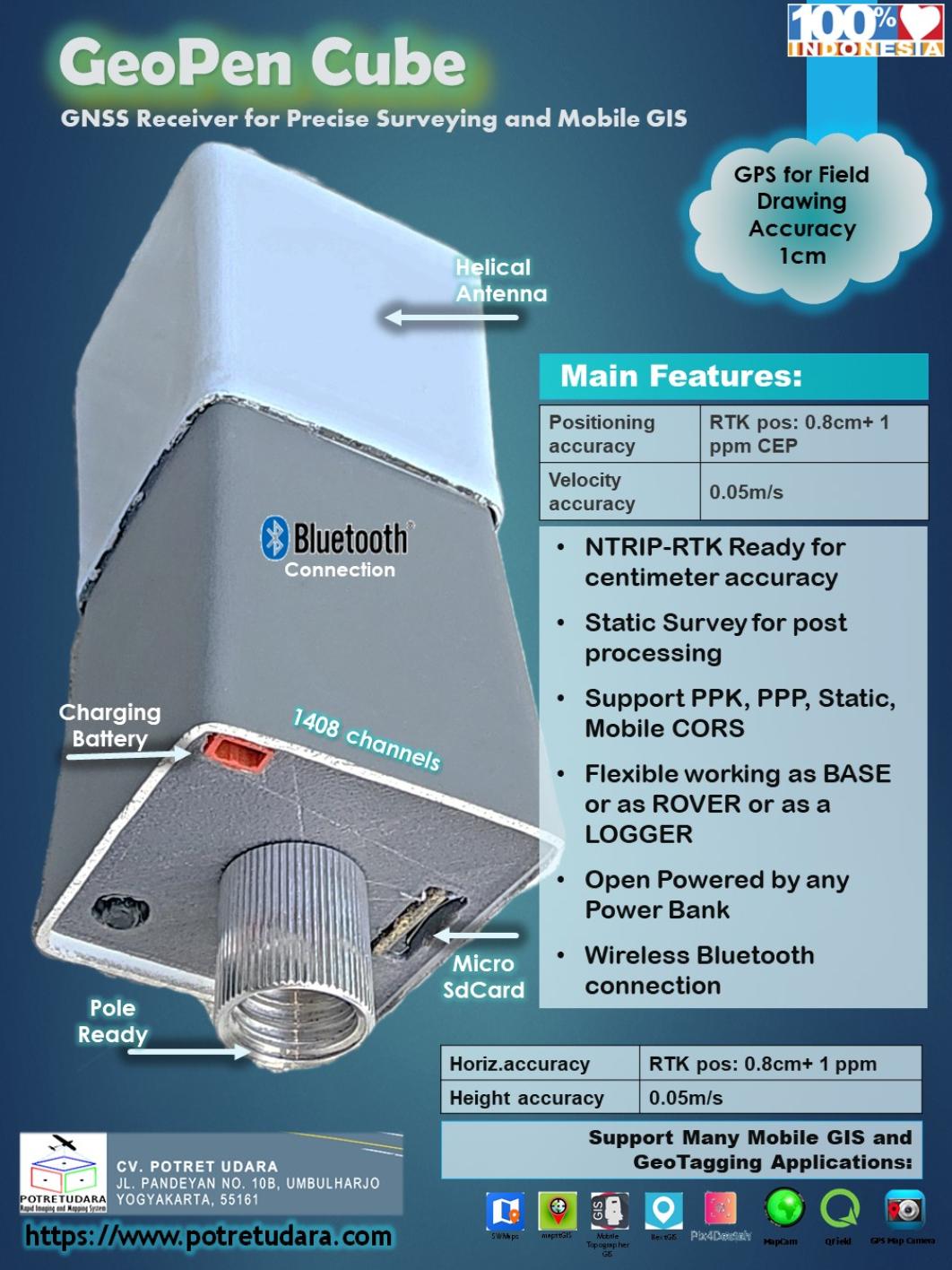

Main Features:
- NTRIP-RTK Ready for centimeter accuracy
- Working as BASE or ROVER
- Open Powered by any PowerBank
- Raw Data Logger for Post Processing
- Wireless Bluetooth connection
- USB Port for PC connection
- Radio Port for RTK Radio connection


A post shared by potretudara (@potretudara)

https://www.instagram.com/reel/CkR6QxjOHkM/?utm_source=ig_web_copy_link
https://www.instagram.com/potretudara/
https://www.instagram.com/p/CkULlC0ymtS/
https://www.instagram.com/p/CkVE3gCIqmI/


Related Products

Potret 1300 UAV for Mapping with PPK technology


  • Kondisi: Baru
  • Berat Satuan: 20 kg
  • Waktu Preorder: 9 Hari

VTOL UAV for mapping Potret 1300 VTOL
PPK ready with > 20mpix camera
cek detail di instagram kami potretudara


A post shared by potretudara (@potretudara)

Potret TLS100
  • Kondisi: Baru
  • Berat Satuan: 10 kg
  • Waktu Preorder: 15 Hari


A post shared by potretudara (@potretudara)


A post shared by potretudara (@potretudara)

Range Distance Natural: 0.2 … 100 m
Resolution 1 cm
Accuracy 10 cm at 100m
Scan Rate 1000 point / Sec
Field of View (deg.): Vert. : -39… 89 Horz. : 360
I/O Micro SDCard, Micro USB
Data Output ASCII
Angle Resolution 0.1125 Deg.
Weight < 1kg (without battery)
Battery - Lipo 4S and Power Adaptor
Support Post Modelling Software CloudCompare MeshLab

Lidar HANDHELD Seri GS-100G Lidar SLAM dengan Software


A post shared by Geosun Navigation (@geosunnav)

  • Waktu Preorder: 15 Hari

Harga dalam US$

GS-100G
HESAI XT 16 Channel laser sensor & AGS 302 with 3 pc Camera

kategori Lidar SLAM yang dipegang tangan Handheld untuk tujuan 3D scanning
menghasilkan point cloud yang dapat
digunakan untuk pemodelan perhitungan 3D dan aplikasi survey lainnya

Have a question?

We are here to answer any questions you have regarding the survey services. Please reach out if you would like to explore your project together or if you need some expert advice.

× Chat with us on WhatsApp