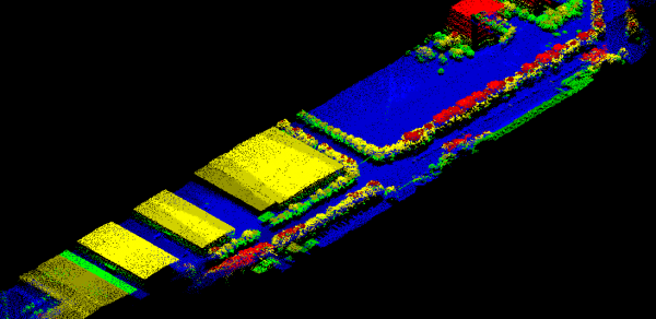
Lidar Based Survey

The lidar based survey services are meet the need to provide 3D analyst of objects that digital camera sensor can not working well. The basic products from lidar based survey are 3D point cloud and its intensity value. The technology are fit for many application such as:

  • -Topography survey
  • -Volumetric analysis
  • -As-Built industrial survey
  • -3D modeling
  • -Building management system
  • -Surface deformation analysis
  • -Hydrology analysis
  • -Mobile Mapping

ORDER VIA BUKALAPAK ORDER VIA TOKOPEDIA

Related Products

GPS geodetic GeoPen HEXA with APGLOS for Mobile GIS

Multi-Purposes GPS for GIS GeoPEN
complete witg APGLOS program for TILT computation
APGLOS is surveying software for Android that change your smartphone to become a precise Data Collector


A post shared by potretudara (@potretudara)


SUPPORT SURVEY MODE:
- Static Relative Post Processing for Ground Control Point ? accuracy less than 1cm
- NTRIP Realtime Kinematic with CORS Station ? accuracy less than 5cm
- PPP Online with IGS Network ? accuracy less than 15cm
- PPK (Post Processing Kinematic) ? accuracy less than 5cm
- RTK with Radio ? accuracy less than 5cm


Main Features:
- NTRIP-RTK Ready for centimeter accuracy
- Working as BASE or ROVER
- Open Powered by any PowerBank
- Raw Data Logger for Post Processing
- Wireless Bluetooth connection
- USB Port for PC connection
- Radio Port for RTK Radio connection


A post shared by potretudara (@potretudara)

https://www.instagram.com/reel/CkR6QxjOHkM/?utm_source=ig_web_copy_link
https://www.instagram.com/potretudara/
https://www.instagram.com/p/CkULlC0ymtS/
https://www.instagram.com/p/CkVE3gCIqmI/


Have a question?

We are here to answer any questions you have regarding the survey services. Please reach out if you would like to explore your project together or if you need some expert advice.

× Chat with us on WhatsApp